Coronavirus in maps: Latest breakdown shows how fast Covid-19 has swept Northern Ireland over last week


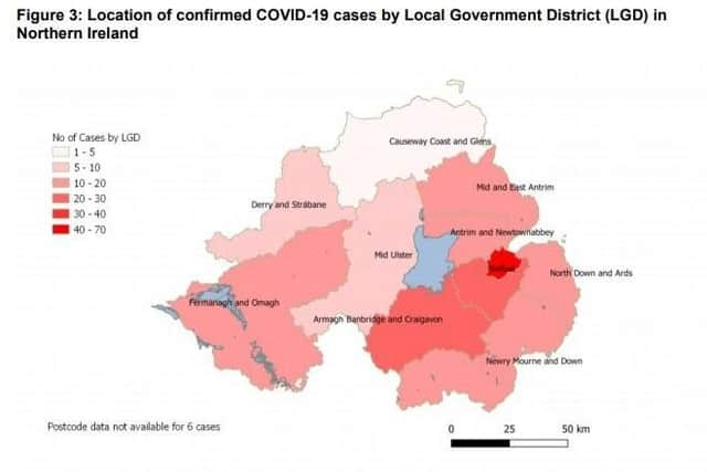
Here, the News Letter reproduces all the PHA’s maps since Tuesday when it started issuing them, giving an indication of the speed of spread.
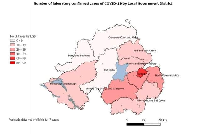
As of today, there have been 34 new cases in Northern Ireland, taking the total to 275.
Advertisement
Hide AdAdvertisement
Hide AdThere have also been another three deaths from Thursday into Friday, taking the total to 13.
There have been just over 4,000 tests carried out on people to date.
The PHA data shows these remain overwhelmingly concentrated in Belfast, where 1,549 tests have happened, compared to 863 in the south-east, the second-highest place.
The age breakdown is as follows: Case Characteristics Number (%)
Age 0 to 44: 36%
45 to 69: 35%
70+: 29%
And 46% are female, and 54% male.
Advertisement
Hide AdAdvertisement
Hide Ad~ NOTE: HTIS ARTICLE HAS NOW BEEN SUPERSEDED BY THIS MORE UP-TO-DATE ONE ~
To keep up with the local picture, see the dedicated Coronavirus section of the News Letter website.
For a global picture, see this regularly updated map from Johns Hopkins University.