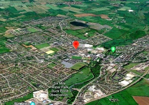
Permission sought for major expansion of town in Co Antrim


The town, located amid rural south Co Antrim, is to be spread out further in a north-westerly direction.
The proposals include a much-vaunted plan for a relief road skirting around that western edge of Ballyclare.
Advertisement
Advertisement
The application for permission were received by planners on December 16, and came to light during a routine News Letter check of planning applications.
But unusually, there is almost no information about the details of the plans.
Usually planning applications come with a slew of blueprints and consultation paperwork, but this application has no such documents attached to it.
This, in full, is how the plans are described:
An application for “major urban extension to include residential neighbourhood, northern section of Ballyclare Relief Road, Public Open Spaces, Children’s Play Area and associated works”.
Advertisement
Advertisement
This will be focussed on “lands adjacent to the North-West of Ballyclare, extending from Rashee Road close to its junction with Corgy Road, continuing across to the North of Ross Avenue/Clare Heights and North and West of Ballyclare Rugby Club, to the North of Doagh Road”.
The applicant is listed as Ballyclare Development LTD, a firm which appears to have no website.
While most planning applications are down to local councils to decide, this one is described as a “reserved matter”, meaning it will be decided at a higher level.
The website Wesleyjohnston.com, run by a man of that name who is an expert in road-building and urban planning, states the following: “Current area plans have marked Ballyclare as a town for significant growth to accommodate some of Northern Ireland’s fast growing population.
Advertisement
Advertisement
“However the town is severely limited by the fact that the only way to get from the north of the town to the south, and hence to Belfast, is via the congested main street.
“This proposal [for the relief road] will not necessarily diminish the traffic on the main street, but it should allow continued housing development in the town without increasing congestion...
“The proposal has been on the cards for at least 20 years,”
Click here – BLM protests: PSNI chief dubbed ‘a weak leader who should say sorry to frontline officers’
A message from the Editor:
Advertisement
Advertisement
Thank you for reading this story on our website. While I have your attention, I also have an important request to make of you.
With the coronavirus lockdown having a major impact on many of our advertisers — and consequently the revenue we receive — we are more reliant than ever on you taking out a digital subscription.
Subscribe to newsletter.co.uk and enjoy unlimited access to the best Northern Ireland and UK news and information online and on our app. With a digital subscription, you can read more than 5 articles, see fewer ads, enjoy faster load times, and get access to exclusive newsletters and content.
Visit https://www.newsletter.co.uk/subscriptions now to sign up.
Advertisement
Advertisement
Our journalism costs money and we rely on advertising, print and digital revenues to help to support them. By supporting us, we are able to support you in providing trusted, fact-checked content for this website.
Alistair Bushe
Editor